City of Detroit 1to1 Scale v1.0.2
A 1 to 1 scale custom map made using real topographical data of Detroit, Michigan, USA. Historically accurate roads (as of 1830) and railroads (as of 1910) are included. Aligned with cardinal directions. Centered at 42.38376*N, 83.05636*W.
I needed to make some emergency fixes to the map, so I decided to fully reupload, apologies for the confusion.
Installation:
– Click the green .zip “Download Link” for the latest map version.
– Extract the .zip file to your “Downloads” folder (or any other safe place).
– Delete everything except the .cok and .cok.cid files (optional).
– Place the .cok and .cok.cid files into the folder “C:/Users/(your username)/AppData/LocalLow/Colossal Order/Cities Skylines II/Maps”.
– – If you cannot see your “AppData” folder, then go to “File” (top left of file explorer), “Change folder and search options”, “View”, “Files and Folders”, “Hidden files and folders”, and check “Show hidden files, folders, and drives”.
– – If you do not have a “Maps” folder, then create a folder called “Maps”, and place the files within it.
Notes:
– This map does not actually require BepInExPack to function.
– The map is perfectly aligned with the cardinal directions (north, south, east, west).
– The map is in 1-1 scale, meaning everything in game will be scaled realistically to the in-game meter (or foot).
– The map covers a square 14.3km across in central Detroit. The precise center of this square is at 42.38376N, 83.05636W. Some landmarks for the square boundaries are:
– – North: 8 Mile Rd, Chrysler Warren Truck Assembly, Woodlawn Cemetery
– – South: Ambassador Bridge US End, Detroit Livernois Rail Yard, Clark Park
– – East: Detroit Yacht Club, Chrysler Jefferson North Assembly, StoneCrest Medical Center
– – West: Santa Rosa Dr, Sherrill Elementary School, Romanowski Park
– – Centerpoint: GM Detroit-Hamtramck Assembly, Russell Industrial Center, Hamtramck
– The square (204 square km) is roughly 55% the size of Detroit’s official city limits (370 square km). Some of the Square’s area is actually the enclaves of Hamtramck and Highland Park, as well as most of Belle Isle, a section of the Detroit River, and a small corner of Windsor on the Canadian side of the water. Plenty of Detroit’s City area lies outside of the map, especially to the west. Detroit City’s official population is 632,000 people.
– The square (204 square km) equals just 2% of the total area of Metropolitan Detroit (10,135 square km). Metro Detroit’s official population is 4,365,000 people.
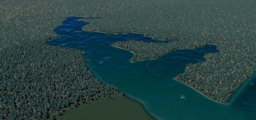
– The terrain has been altered from the raw heightmap output, especially around the coasts. Some of this was to remove obvious artifacts (like the inclusion of highway ramps as “hills”), while the rest was to even out the heights of the riverbanks to allow for a more realistic river. I tried to make my alterations as subtle as possible.
– The railroads are as accurate as I could make them (including elevations), and cover all of the rail lines ever built within the map area that I know about (finishing around 1910). The only omissions are railyards and rail stations, which I replaced with straight track so players can insert these where they see fit.
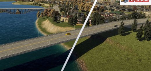
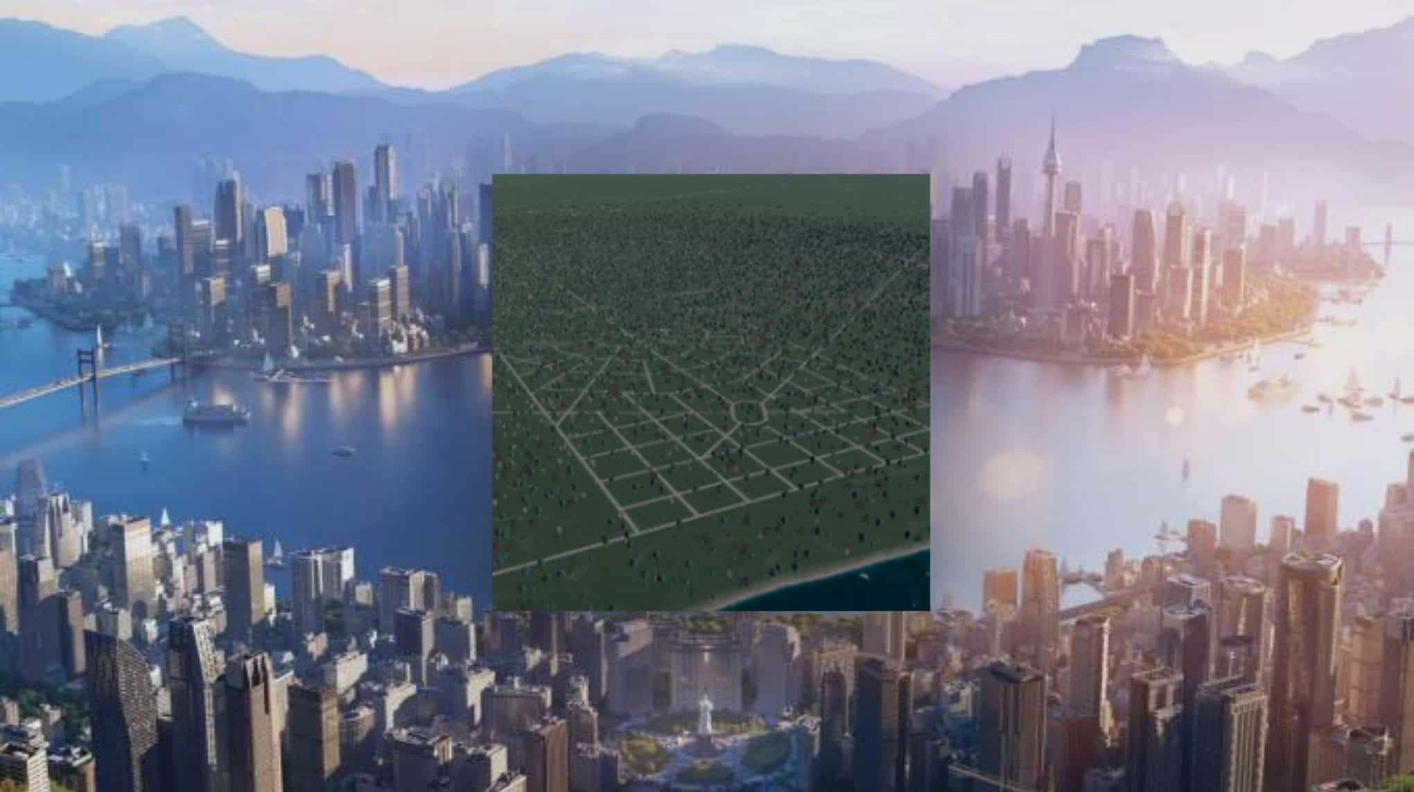
– The roads are built as of 1830, outlined in gravel; and cover the finished portion of the “Woodward Plan” as well as the six major avenues leading into/out of the city (Fort, Michigan, Grand River, Woodward, Gratiot, and Jefferson). I have straightened out and mirrored the roads as much as possible (straightening out roads, mirroring angles, averaging block sizes, etc) to create a “cleaner” downtown area for building. The two biggest changes were turning the entire grid clockwise slightly (allowing Fort and Jefferson to actually parallel the Detroit River), and shifting Gratiot one block south (allowing it to connect to the Campus Martius directly, as originally planned by Woodward).
– – I was unable to rename the roads in the editor, so they retain generic names instead.
– The roads and railroads form plenty of outside connections for the city. These are supported with four air connections (roughly near each map corner), and two ship connections (one south of Belle Isle, the other at the southern edge of the Detroit River). Players can form a powerline and water/sewer connection using the starting tiles.
– The map’s climate matches that of the base “Sweeping Plains” map, as this is closest to Detroit’s actual temperature range.
– No Ore or Oil resources exist on the map, as is the case in reality. However, the map contains plentiful Groundwater and Fertile Land, while being covered in a dense forest mix of Oak, Pine, and Birch trees, all native to the area. The Detroit River also flows through the starting square, which has a slow but consistent southwestern flow, with a very high volume of clean water to draw from. This matches the natural landscape of the Detroit area up to the late 1700s, when settlement and farming began around Fort Detroit.
– I could not figure out how to edit wind patterns in the editor, however the map does have a very strong wind field. This wind evenly spreads outwards in all directions from a point near the intersection of Grand River Avenue and the (elevated) Grand Trunk Railroad.